Bringing Your
Story To Life
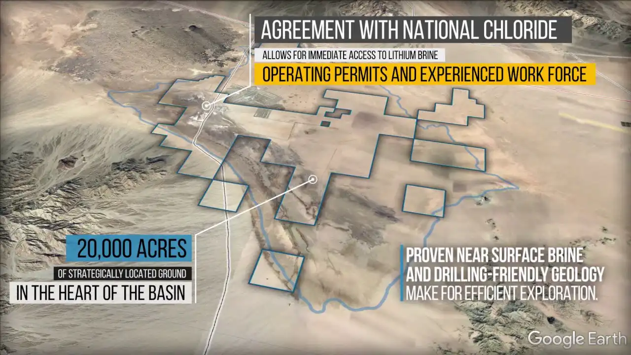
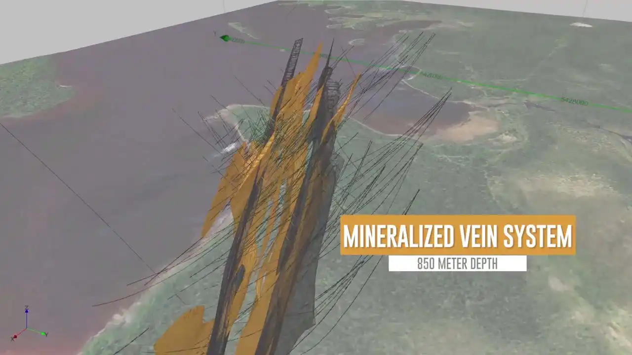
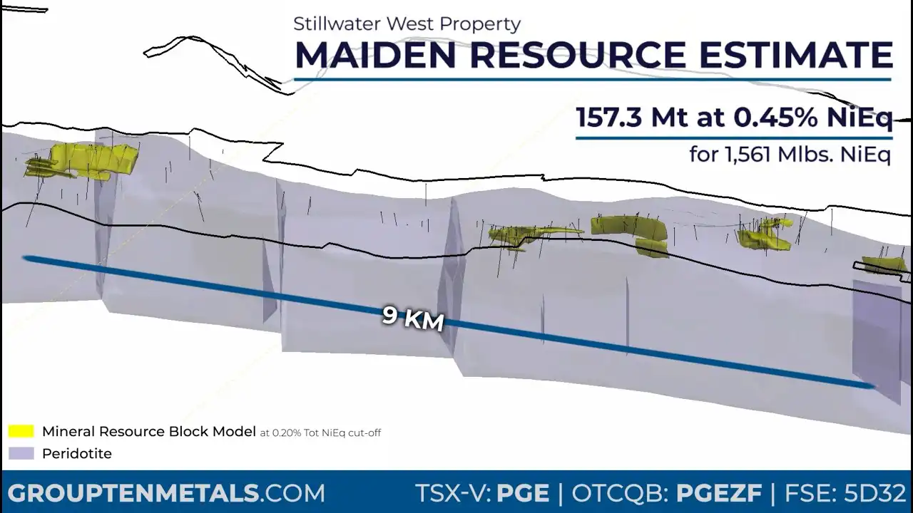
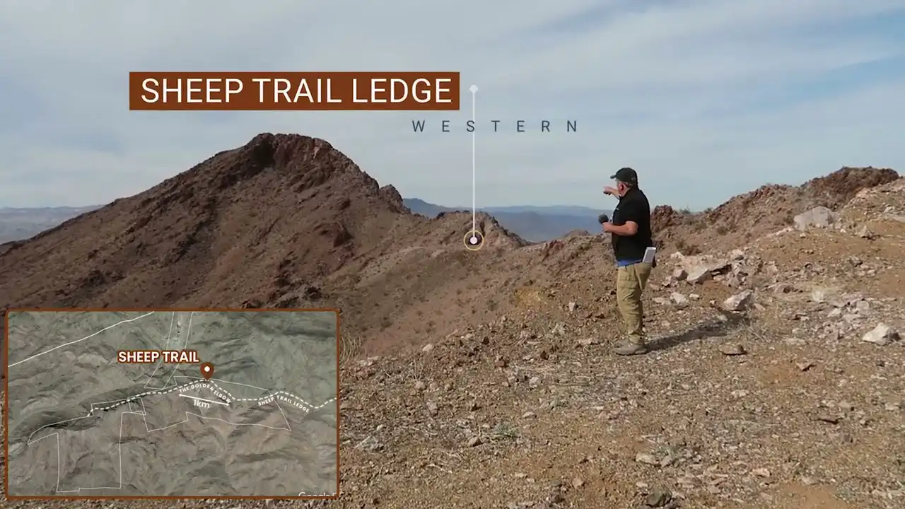
Videos are today’s most effective marketing format. Integrate your mapping and drillhole information into sophisticated 3D software, and gain higher traction with potential investors.
Videos are today’s most effective marketing format. Integrate your mapping and drillhole information into sophisticated 3D software, and gain higher traction with potential investors.

Every video starts with a clear narrative. We work with your team to define the story you want to tell—key messages, milestones, and investor takeaways—then translate that into a tight storyboard and script that sets structure, pacing, and visual intent before production begins.
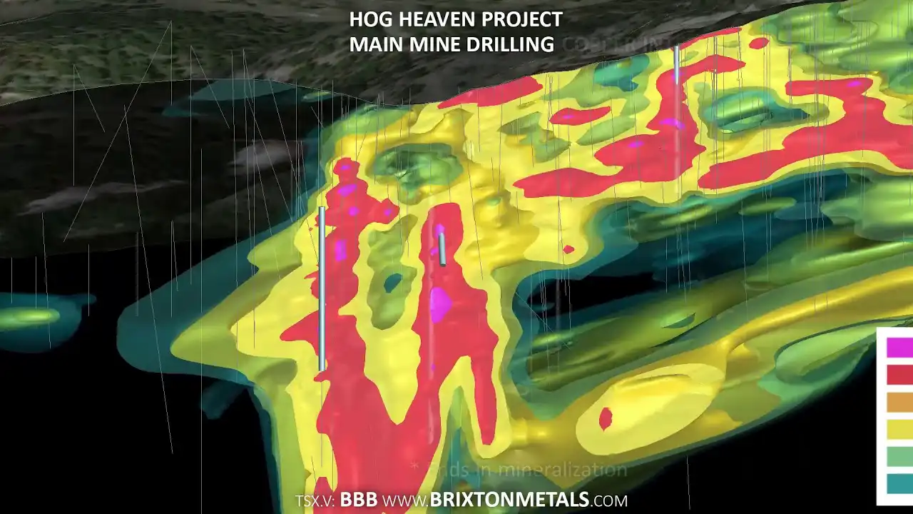
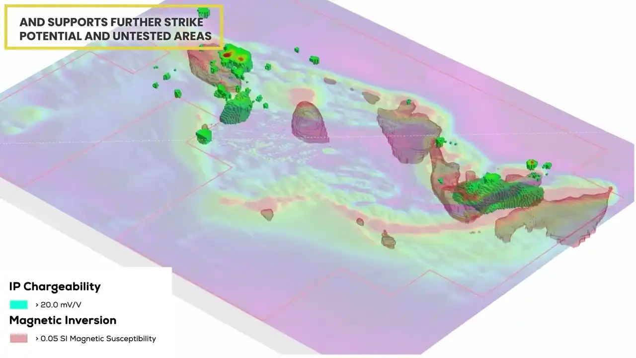
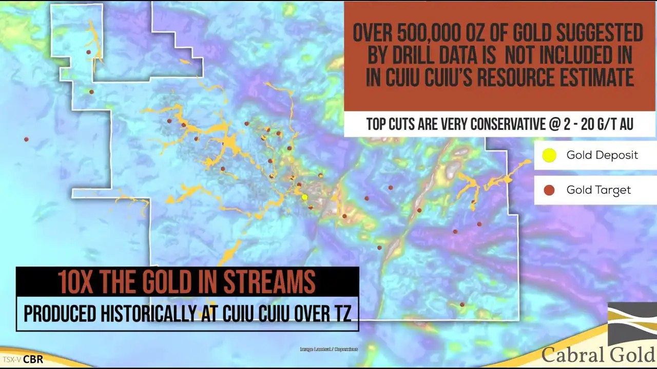
We integrate your technical data directly into the process. Mapping, drillhole data, models, imagery, and site assets are compiled and validated, then prepared for use in advanced 3D and motion software to ensure accuracy, clarity, and visual consistency across the project.
With the story and data locked, we produce polished video outputs tailored to your needs—corporate presentations, brand marketing videos, social content, ads, or drone-integrated footage. The result is a visually compelling, technically sound video designed to engage investors and stakeholders across all platforms.